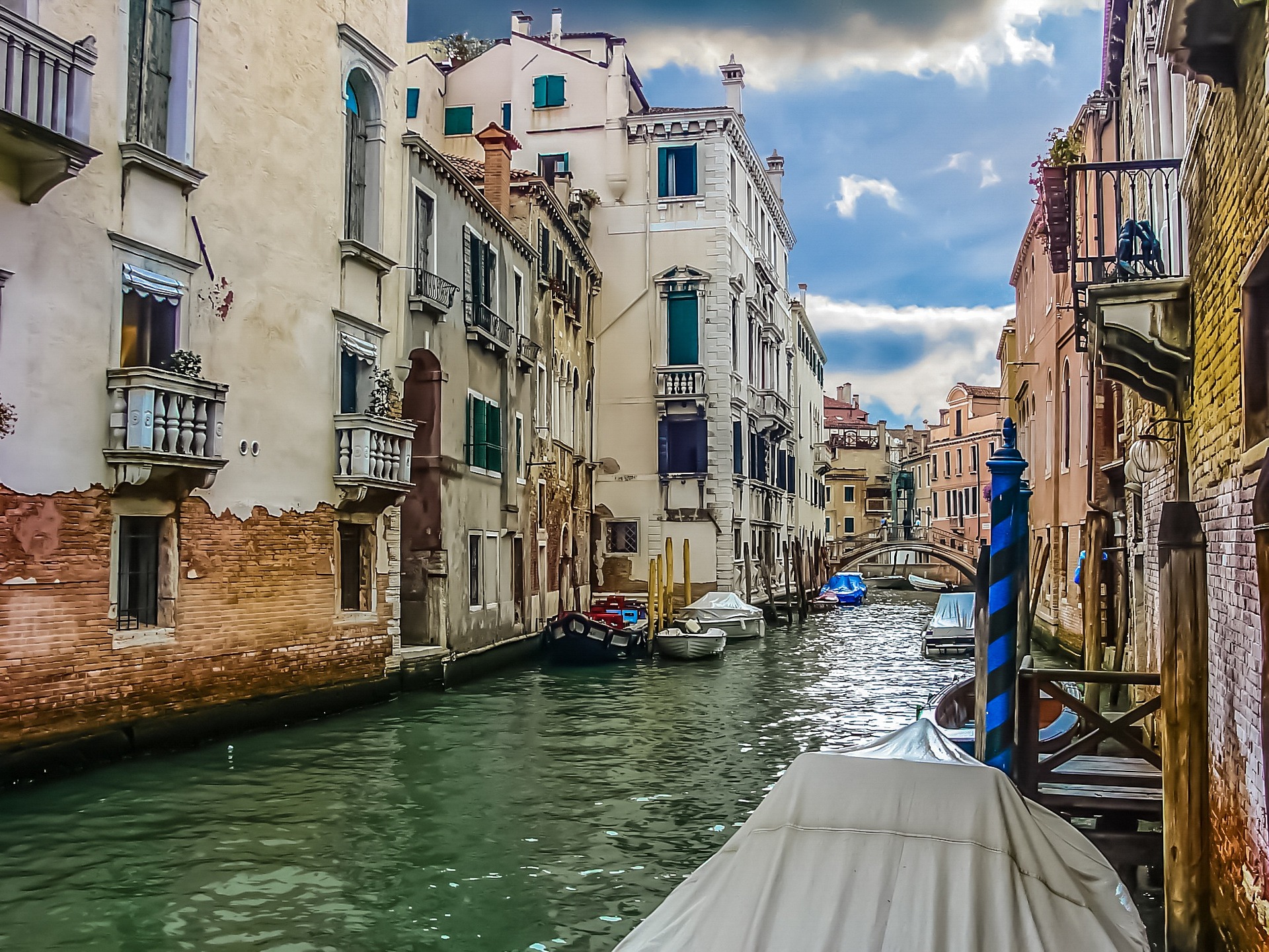
Venice is often described as a city built on water, but its canals are far more than picturesque decorations. They function as streets, transport routes, delivery corridors, architectural spaces, and quiet extensions of the surrounding neighbourhoods.
The Grand Canal receives most of the attention, yet many of Venice’s most atmospheric views are found along narrow waterways in Dorsoduro, Cannaregio, Castello, and San Polo. Some canals are framed by monumental palaces, while others pass modest homes, workshops, churches, boatyards, and waterfront restaurants.
The coordinates in this guide indicate the best publicly accessible viewpoint, usually a bridge or waterfront promenade, rather than the geographical centre of the canal.
Venice’s Most Beautiful Canals at a Glance
| Canal | District | Recommended viewpoint | Coordinates |
|---|---|---|---|
| Grand Canal | Dorsoduro–San Marco | Ponte dell’Accademia | 45.431684, 12.328950 |
| Rio di Palazzo | San Marco–Castello | Ponte della Paglia | 45.433586, 12.341039 |
| Rio di San Barnaba | Dorsoduro | Ponte dei Pugni | 45.433150, 12.324364 |
| Rio di San Felice | Cannaregio | Ponte Chiodo | 45.442833, 12.334722 |
| Cannaregio Canal | Cannaregio | Ponte delle Guglie | 45.443668, 12.325562 |
| Cannaregio Canal | Cannaregio | Ponte dei Tre Archi | 45.445583, 12.320737 |
| Rio dei Mendicanti | Castello | Ponte Cavallo | 45.439472, 12.341167 |
| Rio dei Greci | Castello | Ponte dei Greci | 45.435730, 12.344340 |
| Rio de la Tana | Castello | Ponte de la Tana | 45.432967, 12.354308 |
| Rio dei Frari | San Polo | Ponte dei Frari | 45.437260, 12.327195 |
| Rio delle Beccarie | San Polo | Ponte de la Pescaria | 45.439925, 12.333810 |
1. The Grand Canal from Ponte dell’Accademia
Location: between Dorsoduro and San Marco
Best viewpoint: Ponte dell’Accademia
Coordinates: 45.431684, 12.328950
The Grand Canal is Venice’s principal waterway and the most monumental canal in the city. It curves through the historic centre, bordered by palaces, churches, museums, hotels, private residences, and former commercial buildings.
Although there are many places from which to see it, the view from the Accademia Bridge is particularly impressive. Looking east, visitors can see the canal widening towards the lower lagoon, with the dome of the Basilica di Santa Maria della Salute rising above the water.
The wooden Ponte dell’Accademia is one of only four bridges crossing the Grand Canal. It connects Dorsoduro with San Marco and stands close to the Gallerie dell’Accademia.
This is one of Venice’s best sunrise locations. In the early morning, boat traffic is relatively light, the bridge is less crowded, and the façades along the canal often catch the first warm sunlight.
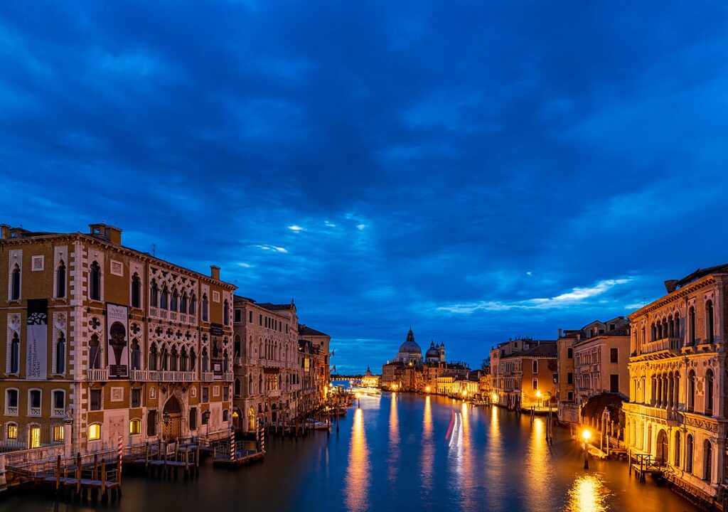
What to look for:
- Santa Maria della Salute in the distance;
- gondolas and water taxis moving beneath the bridge;
- historic palace façades reflected in the canal;
- the changing perspective as the canal bends towards St Mark’s Basin.
2. Rio di Palazzo and the Bridge of Sighs
Location: beside the Doge’s Palace, near St Mark’s Square
Best viewpoint: Ponte della Paglia
Coordinates: 45.433586, 12.341039
Rio di Palazzo, also known as Rio della Canonica, is one of the most photographed narrow canals in Venice. It runs between the Doge’s Palace and the former prison complex and passes beneath the famous Bridge of Sighs.
The enclosed white-stone bridge connects the Doge’s Palace with the New Prison. It was designed by Antonio Contin and completed at the beginning of the 17th century.
The classic public view is from Ponte della Paglia, located on the busy waterfront promenade east of the Doge’s Palace. The bridge has long served as the principal observation point for the Bridge of Sighs.
Because this location becomes extremely crowded during the day, the best time to visit is before 8:00 a.m. Evening can also be attractive, although the canal itself receives limited direct sunlight because of the tall surrounding buildings.
The canal is relatively short, but its enclosed architecture creates one of Venice’s most recognisable compositions: a narrow ribbon of water, pale stone walls, small bridges, and gondolas passing beneath the Bridge of Sighs.
3. Rio di San Barnaba
Location: Dorsoduro
Best viewpoint: Ponte dei Pugni
Coordinates: 45.433150, 12.324364
Rio di San Barnaba is one of the most appealing canals in Dorsoduro. It combines colourful residential façades, moored boats, small shops, traditional bridges, and views towards the Church of San Barnaba.
Unlike the heavily visited waterways around St Mark’s Square, this canal feels closely connected to everyday Venetian life. Residents walk along its fondamente, delivery boats stop beside the buildings, and local vessels are tied to wooden poles along the banks.
The recommended viewpoint is Ponte dei Pugni, or the Bridge of Fists. The bridge was historically associated with confrontations between rival Venetian factions, whose fighters attempted to force one another into the canal. Markings on the bridge recall the starting positions used during these contests.
From the bridge, walk east towards Campo San Barnaba and continue along Fondamenta Gherardini. The canal becomes especially attractive in the late afternoon, when warm light reaches the ochre, brick, and cream-coloured façades.
The Church of San Barnaba has a neoclassical façade, while its separate bell tower preserves much older elements. The square and church were also used as a filming location for Indiana Jones and the Last Crusade.
4. Rio di San Felice at Ponte Chiodo
Location: Cannaregio
Best viewpoint: Ponte Chiodo
Coordinates: 45.442833, 12.334722
Rio di San Felice is a quiet residential canal in northern Cannaregio. Its best-known feature is Ponte Chiodo, one of the few remaining Venetian bridges without conventional side railings.
The bridge leads to a private building rather than forming part of a major pedestrian route. Its open sides create an unusually clear view over the water, although visitors should remain on the public approach and respect the privacy of residents.
Ponte Chiodo crosses Rio di San Felice near Ramo de la Misericordia and Fondamenta San Felice. The bridge is built of brick and is named after the Venetian family that once owned the property to which it provided access.
The surrounding canal is narrower and more intimate than the nearby Rio della Misericordia. Reflections are particularly attractive on windless mornings, when the water mirrors the brickwork, shutters, balconies, and small boats.
This location is suitable for travellers searching for a quieter side of Venice. It lies away from the principal route between the railway station and St Mark’s Square, yet it remains within walking distance of the Ca’ d’Oro area and the Fondamenta della Misericordia.
5. Cannaregio Canal from Ponte delle Guglie
Location: western Cannaregio
Best viewpoint: Ponte delle Guglie
Coordinates: 45.443668, 12.325562
The Cannaregio Canal is one of the broadest waterways outside the Grand Canal. It historically provided an important connection between the northern lagoon and Venice’s central canal system.
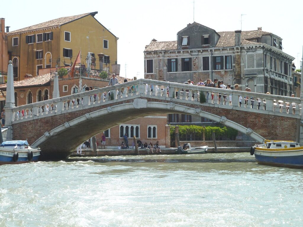
Ponte delle Guglie stands near the canal’s eastern end, not far from Venezia Santa Lucia railway station. Its name refers to the decorative spires positioned around the bridge. It is the only Venetian bridge distinguished by this type of ornamentation.
From the top of the bridge, the view opens along the canal towards residential Cannaregio. The waterway is lined with tall façades, local businesses, boat landings, and long waterfront pavements.
This area is livelier than many smaller canals. Water buses, service vessels, private boats, and pedestrians all pass through it, making the location particularly suitable for travellers interested in Venice as a functioning city rather than only as a historic monument.
The bridge also marks a convenient entrance to the former Jewish Ghetto and the quieter northern sections of Cannaregio. The district is known for secluded lagoon-side corners, churches, historic architecture, and traditional neighbourhood restaurants.
6. Cannaregio Canal from Ponte dei Tre Archi
Location: northwestern Cannaregio
Best viewpoint: Ponte dei Tre Archi
Coordinates: 45.445583, 12.320737
For a less crowded perspective on the Cannaregio Canal, continue west to Ponte dei Tre Archi. This bridge is farther from the main visitor routes and provides a broader, more residential canal view.
Ponte dei Tre Archi is the only surviving three-arched bridge in Venice. It connects the Fondamenta San Giobbe area with the opposite side of the Cannaregio Canal.
The central arch is larger than the two side arches, giving the structure a distinctive profile. From the bridge, visitors can look along long sections of the canal, with boats, quays, churches, and residential buildings extending in both directions.
The area is most attractive around sunset, when the western sky can illuminate the open water. It is also a good place to observe local boat traffic without the concentrated crowds found near Rialto or San Marco.
Ponte delle Guglie and Ponte dei Tre Archi can easily be combined in one walk. The waterfront route between them is short, level, and lined with places where visitors can stop beside the canal.
7. Rio dei Mendicanti
Location: Castello, beside Campo Santi Giovanni e Paolo
Best viewpoint: Ponte Cavallo
Coordinates: 45.439472, 12.341167
Rio dei Mendicanti is one of the finest canal views in northern Castello. It runs beside the monumental complex of Santi Giovanni e Paolo and the historic hospital buildings.
The recommended viewpoint is Ponte Cavallo, which crosses the canal beside Campo Santi Giovanni e Paolo. The bridge provides a long view along the water, framed by high masonry walls, residential buildings, small bridges, and passing boats.
This waterway is also associated with an early Venetian view painted by Canaletto in the 1720s. The historic composition shows the canal as an active urban space filled with bridges, buildings, laundry, and waterfront activity.
The canal remains visually impressive because of the contrast between monumental architecture and ordinary neighbourhood life. Visitors may see ambulances and service boats using the waterway, since Venice’s hospital complex is located nearby.
Castello is Venice’s largest district and is known for combining major artistic landmarks with lively residential streets and an atmosphere of everyday local life.
8. Rio dei Greci
Location: Castello, east of St Mark’s Square
Best viewpoint: Ponte dei Greci
Coordinates: 45.435730, 12.344340
Rio dei Greci is a narrow and elegant canal best known for its view of the leaning bell tower of San Giorgio dei Greci.
The canal runs through an area historically associated with Venice’s Greek community. The Church of San Giorgio dei Greci was constructed during the 16th century and remains one of the neighbourhood’s principal landmarks.
From Ponte dei Greci, the canal is framed by warm-coloured buildings, shuttered windows, small private bridges, and the distinctive campanile rising above the rooftops. The tower’s visible inclination gives the view an unusual character.
The exact bridge viewpoint is located at approximately 45.43573, 12.34434, while another attractive perspective can be found slightly south along the canal.
This area is only a short walk from the crowded Riva degli Schiavoni, but it feels considerably calmer. The contrast makes Rio dei Greci an excellent detour for visitors travelling between St Mark’s Square and the eastern districts of Venice.
9. Rio de la Tana and the Venetian Arsenal
Location: eastern Castello
Best viewpoint: Ponte de la Tana
Coordinates: 45.432967, 12.354308
Rio de la Tana presents a different side of Venice. Instead of ornate palace façades, the canal is bordered by the long brick walls and historic industrial architecture associated with the Venetian Arsenal.
The Arsenal was once the centre of Venice’s shipbuilding and naval power. The waterways surrounding it were designed for practical movement, construction, defence, and access to the lagoon.
From Ponte de la Tana, visitors can see the canal extending beside imposing brick structures, stone embankments, workshops, and occasional boats. The viewpoint’s mapped location is approximately 45.432967, 12.354308.
This canal is particularly atmospheric on cloudy days or in the late afternoon. The massive walls, relatively open sky, and less decorative architecture create a mood quite unlike the polished views of the Grand Canal.
The surrounding streets are generally quieter than central San Marco. The canal can be incorporated into a walk through the Arsenal, Via Garibaldi, and the neighbourhoods surrounding the Venice Biennale sites.
10. Rio dei Frari
Location: San Polo
Best viewpoint: Ponte dei Frari
Coordinates: 45.437260, 12.327195
Rio dei Frari runs beside the Basilica di Santa Maria Gloriosa dei Frari, one of Venice’s most important religious buildings.
The best viewpoint is Ponte dei Frari. From here, visitors can see the narrow canal passing beside brick façades, old residential buildings, waterside entrances, and the imposing walls of the church complex.
The bridge’s mapped position is approximately 45.437260, 12.327195. It crosses the Rio dei Frari immediately beside the basilica.
The canal is especially attractive because it does not depend on elaborate decoration. Its appeal comes from the combination of brick architecture, quiet water, small bridges, and the monumental scale of the Frari church.
Visit early in the morning for an almost empty view, or arrive shortly before the basilica opens and combine the canal with an interior visit. The surrounding San Polo district contains numerous narrow lanes and smaller waterways, making it ideal for an unhurried walking route.
11. Rio delle Beccarie near Rialto Market
Location: San Polo, beside Rialto Market
Best viewpoint: Ponte de la Pescaria
Coordinates: 45.439925, 12.333810
Rio delle Beccarie is a short canal in the Rialto market district. It does not have the grandeur of the Grand Canal, but it offers one of the clearest views of Venice’s traditional commercial character.
The recommended viewpoint is Ponte de la Pescaria, close to the historic market buildings. Its coordinates are approximately 45.439925, 12.333810.
In the morning, the surrounding area becomes active with market deliveries, handcarts, boats, local shoppers, and restaurant workers. Later in the day, the district becomes quieter, although the nearby Rialto routes remain busy.
The canal is bordered by functional waterfront structures rather than uninterrupted palace façades. This gives it a more authentic commercial atmosphere and demonstrates how canals continue to serve as delivery routes.
For photography, morning is the most interesting period. Visitors should avoid obstructing working areas, bridges, or the movement of goods through the market.